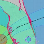
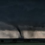
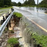
Colorado State University researchers today predicted a “somewhat below-normal” Atlantic hurricane season: 13 named storms, instead of 14 to 15 in an average year, six hurricanes instead of seven, and two reaching major storm strength instead of three. Flagler County Emergency Management Direcxtor Jonathan Lord cautioned against putting too. much stock on forecasts.
Weather and Climate
Severe Drought Expands Across Flagler, Northern and Western Counties After 4 Months of Dry Weather
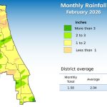
The St. Johns River Water Management District reports significant hydrologic declines following four months of minimal rainfall. All eighteen counties recorded below-average precipitation during February. These dry conditions caused groundwater levels in the Upper Floridan aquifer to drop into the eleventh percentile. Most of the state currently faces moderate to extreme drought. Residents should follow Phase I water shortage restrictions to preserve dwindling regional water supplies during this period.
Palm Coast and Flagler Beach Cancel Holiday Parades as Weather Hijacks Santa’s Sleigh; No Rain Dates
There was no Santa parachuting from a plane this morning in Flagler Beach and there will be no Santa on a firetruck this evening in Palm Coast’s Town center as grayly grinchy weather forced both cities to cancel their holiday parades. For Palm Coast, it is the fifth time in six years that the Starlight Parade has had to be cancelled, with 2024 the only year in that span when it was held without a hitch.
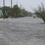
For Flagler County’s I-95 Corridor, Long Duration Nor’Easter Brings High Winds, Potential Flooding and Erosion
The National Weather Service in Jacksonville is cautioning that a “long-duration nor’easter’ began today and will continue through Saturday, bringing wind and heavy downpours along the I-95 corridor, high tides 2 to 3 feet above normal and dangerous surf that will batter and damage Flagler County’s beaches, and potential coastal flooding. Calmer, dryer weather returns Sunday.
Creekside Music and Arts Festival Set for Weekend Is Postponed to February as Precaution Against Storms
The Creekside Music and Arts Festival scheduled for this weekend–Oct. 4 and 5–at Princess Place Preserve in Flagler County is being rescheduled to February due to an inclement forecast of lightning and storms ahead. The festival, the largest cultural festival on the county’s calendar, both in attendance and vendors, is rescheduled to February 7 and 8. It is the second time in eight years that the festival has had to be postponed due to weather. In 2017, in the aftermath of Hurricane Irma, it was moved to November.
Why FEMA Is Essential in Disasters
To better understand FEMA’s value, let’s take a look back at how the nation responded to disasters before the agency existed–it wasn’t pretty– and what history reveals about when FEMA was most effective.
A Disaster Expo at the Palm Coast Community Center Highlights Community’s Prepared Resilience
Flagler Cares, the social services non-profit and coordinating agency, secured a $143,000 Long-Term Recovery Grant from the American Red Cross for Flagler Volunteer Services as part of the recovery efforts following Hurricanes Helene and Milton in 2024, enabling a “disaster preparedness breakfast and expo” at the Palm Coast Community Center Tuesday that drew a full house.
Hurricane-Bound Erin, 1st Major Storm of Season, Not Expected to Affect Florida
Tropical Storm Erin, still churning closer to the African coast than the American or Caribbean, is expected to become a major hurricane by the weekend as it moves west. It is not expected to pose a danger to the Florida Peninsula, Flagler County included, Flagler County Emergency Management Director Jonathan Lord said today. But he added a word of caution: Erin is too far to rule out a more onerous turn.
Atlantic Awakens: Hurricane Center Eyes Two Weather Systems with Tropical Storm Potential
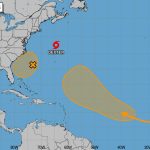
The National Hurricane Center is monitoring two weather systems for potential tropical development over the next seven days, including one near the southeast Atlantic coast. This system now has a 40 percent chance of tropical cyclone formation on Friday or Saturday, up from 30 percent. Another system, currently in the eastern, tropical Atlantic, has a 50 percent chance of tropical storm formation in seven days.
As Texas Flood Death Toll Passes 50, Questions Arise Over Adequate Warnings and NWS Staffing
Catastrophic flooding that has claimed more than 50 lives in Texas came amid concerns about staffing levels at the NWS, after the Trump administration fired hundreds of meteorologists this year as part of Elon Musk’s DOGE cuts. The NWS Austin/San Antonio office’s warning coordination meteorologist announced in April that he was retiring early due to the funding cuts, leading to speculation that vacancies could have impacted forecasters’ response.
Trump Is Shutting Down 3 Key Weather Satellites Ahead of Peak Storm Season
On June 25, 2025, the Trump administration issued a service change notice announcing that the Defense Meteorological Satellite Program, DMSP, and the Navy’s Fleet Numerical Meteorology and Oceanography Center would terminate data collection, processing and distribution of all DMSP data by July 31. The satellite data helps meteorologists create weather forecasts that keep planes and ships safe and prepare countries for a potential hurricane landfall.
Rain on Independence Day? Worst Expected in Mid-Afternoon, Less Likely During Fireworks
The National Weather Service in Jacksonville is predicting that the highest probability of rain in the Flagler Beach-Palm Coast region will be from 3 to 6 p.m., with a 6 percent chance at 3, falling to a 45 percent chance at 6 and 30 percent by 9 p.m.
Heavy Rainfall May Dampen July 4 Weekend
The National Weather Service is cautioning that Palm Coast, Flagler County and Northeast Florida are in for a soaking over the Independence Day weekend, with local accumulations of several inches possible.
Governors Pick Up Where Presidents Abandoned Fight Against Climate Change
In recent years, the real progress against climate change has been outside the rooms where the official U.N. negotiations are held, not inside. In these meetings, the leaders of states and provinces talk about what they are doing to reduce greenhouse gases and prepare for worsening climate disasters. Many bilateral and multilateral agreements have sprung up like mushrooms from these side conversations.
Flagler Emergency Management Director Jonathan Lord Warns of a Different Disaster Ahead: the Vanishing of FEMA Money
With or without FEMA, Emergency Management Director Jonathan Lord cautioned, local governments must be prepared to assume more costs of recovery than they have in the past, especially if the federal government declares fewer disasters, as appears to be the plan. Fewer declarations will mean far less reimbursements and far fewer grants for innumerable projects and services local governments depend on in the recovery phase of what are becoming routine climate disasters.
NOAA Cuts Are Putting Our Coastal Communities At Risk
For Americans on the Gulf or Atlantic coasts, the daily weather forecast always comes with a constant thrum of worry — any small disturbance in the Atlantic has the potential to evolve into a major storm. And as hurricane season gets underway, the palace intrigue, staffing cuts at NOAA, and general upheaval of national leadership could have dire effects for people on these coasts.
17 Named Storms Predicted for Hurricane Season
Colorado State University researchers Thursday forecast 17 named storms during this year’s Atlantic hurricane season, with nine reaching hurricane status and four becoming major storms. That would make the 2025 season close to the 2024 season, which included three hurricanes making landfall in Florida.
Why Forecasting A Tornado’s Strike Zone Is Still Elusive
Pinpointing exactly where a tornado will touch down – like those that hit states including Indiana, Missouri, Arkansas, Mississippi and Alabama on March 14 and 15 – still relies heavily on seeing the storms developing on radar.
Ag Commissioner on Heat-Related Farm Deaths: Blame Humans, Not Climate
Agriculture Commissioner Wilton Simpson told state lawmakers Tuesday morning that human error was to blame for heat-related deaths on farms, which he described as few and far between. Florida’s sweltering heat became one of the hottest topics for lawmakers last year as the Republican-led Legislature passed a law prohibiting local governments from enacting their own heat-safety protections for employees.
Sorry Palm Coast, No Snow For You: Winter Storm Warning Boundaries Are North and West of Flagler
If you’re hoping to see a few snow flurries as a rare winter storm barrels through the Gulf of Mexico, you’ll have to go north and west of Flagler County even as winter storm warning boundaries were extended southward to include all of Duval and Clay counties overnight. Putnam and St. Johns have a winter storm advisory.
Global Temperatures Passed Critical 1.5°C Milestone for First Time in 2024
2024 was the first year on record with a global average temperature exceeding 1.5°C above pre-industrial levels. All continents except Australasia and Antarctica experienced their hottest year on record, with 11 months of the year exceeding the 1.5°C level. Global temperatures have been at record levels – and still rising – for several years now. The previous hottest year on record was 2023.
How the Santa Ana Winds Fuel California’s Deadly Fires
Thousands of homes and other structures, including several schools, had burned by Jan. 9, and at least five people had died. Officials urged more than 180,000 residents to evacuate at the height of the fires. With the winds so strong, there was little firefighters could do to control the flames. Here’s what causes extreme winds like this in Southern California, and why they create such a dangerous fire risk.
Kevin Guthrie and UF Show Off AI-Powered Disaster Information Dissemination Service
The University of Florida, in partnership with government agencies, has showcased an artificial intelligence-driven disaster warning system leveraging radio waves — a program Florida Department of Emergency Management Director Kevin Guthrie said is guaranteed to save lives.
Radar in Bunnell Could Vastly Improve Dangerous Weather Forecasting–If Only Forecasters Could Access It
Since June a 330-pound radar with an estimated value of $120,000 to $150,000 has sat atop a 100-foot monopole at the Emergency Operations Center in Bunnell, one of only three like it in the state. It could vastly improve forecasting of dangerous weather such as imminent tornadoes. Except that the National Weather Service has not been able to access its data.
Hurricane Milton’s Flagler Path in Pictures: Flooding, Beach Erosion, Damaged Roads and Roofs, but Nothing Disastrous
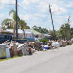
Hurricane Milton barreled through the midsection of the Florida Peninsula Thursday morning, lashing Flagler County with tropical-storm-force winds (and a few hurricane-force gusts) and up top 19 inches of rain in parts of the county. But damage overall was mostly minor despite floodwaters. Here’s an album in pictures and video.
From Charley to Milton, 20 Years of Hurricanes and Florida Learned Nothing
Back in 2004, the Florida Department of Community Affairs ensured that evacuation times from flood-prone zones known as Coastal High Hazard Areas took less than a day. The law said the development density in those areas should not make the evacuees need more than 16 hours to get away from a Category 5 storm. Then Rick Scott and the Legislature killed the agency. Evacuation times have been getting worse, making life on those islands more dangerous.
With Hurricane Milton’s Worst Ahead, Torrential Rains Raise Flooding Concerns in Palm Coast and Close Roads
Torrential rain in Palm Coast ahead of Hurricane Milton has “severely overwhelmed” the city’s stormwater system. Milton’s advance rain bands have led to a few street closures in the B Section, to city crews special-delivering sand bags to some residents, and to an alert from the city to residents to minimize water usage as the stormwater system is being overwhelmed by precipitation–with the worst yet to come.
Evacuations Ordered for Entire Barrier Island and Much of Mainland East of I-95, Curfew Wednesday Night
Hurricane Milton’s projected path has remained remarkably steady with very slight variations north or south, but with models agreeing on landfall in the Tampa Bay area after midnight Thursday and now mostly merging to agree on a path along or a bit south of I-4, toward Merritt Island and the Space Coast, where it would exit, still as a hurricane, Thursday afternoon. Tropical-storm force winds ranging between 40 and 70 mph are expected in Flagler County, with the possibility of hurricane-force winds especially on the barrier island.
Milton Could Be Among ‘Most Destructive Hurricanes on Record,’ NHC Warns; Flagler Readies for Flooding; Cancellations Multiply
Hurricane Milton, now a monster storm, had sustained winds of 180 miles per hour, making it one of the most intense and dangerous hurricanes ever recorded. It had crashed NHC’s site in early evening Monday, as Florida’s midsection was bracing for a direct hit in the Tampa Bay area and Flagler County was preparing for severe impacts and potential hurricane-force winds that it did not record even during Hurricanes Mathew and Ian in 2016 and 2017.
Ahead of Hurricane Milton, State Emergency Director Guthrie Warns of Possibly ‘Largest Evacuation’ Since 2017
With Hurricane Milton expected to reach Category 3 or 4 force before hitting Florida in the middle of the week, state Division of Emergency Management Director Kevin Guthrie on Sunday urged residents to immediately start putting storm plans in place, which could include evacuating further inland.
Hurricane Milton, Gaining Force Quicker, Is Barreling Toward Florida’s I-4 Corridor and Flagler By Midweek
Eleven days after Hurricane Helene made landfall in Florida’s Big Bend, Tropical Storm Milton, expected to be Hurricane Milton by tonight, is rapidly gaining strength and is expected to become a major hurricane by Tuesday. It is mobilizing Florida from Tampa Bay through the north-central midsection of the state, including Flagler County, where severe conditions and impacts are expected. Tropical-storm-force winds are expected in Flagler County late Tuesday night into Wednesday. The rainfall potential over the next five days for coastal Flagler County, including Flagler Beach and Beverly Beach, is in the 8 to 12-inch range, and in the 6 to 8 inch range for inland Flagler.
Sen. Rick Scott Finally Concedes: Climate Is ‘Clearly Changing’
Florida U.S. Sen. Rick Scott acknowledged Friday in the devastating aftermath of Hurricane Helene that the climate is “clearly changing,” adding: “We’ve gotta figure out how do we react to that.” Scott travelled through parts of the state speaking to law enforcement and first responders a day after the Category 4 hurricane caused record storm surge up the west coast and Big Bend region of Florida, with at least seven deaths in the state attributed to the storm.
‘Catastrophic’ Helene Landfall Projected for Big Bend This Evening, But Limited Outer-Band Impacts in Flagler-Palm Coast
In Northeast Florida, including Flagler County, outer rain bands will increase in frequency today, with stronger winds arriving after noon and local impacts increasing through Thursday night, the National Weather Service in Jacksonville says. But rain totals in coastal Flagler and Palm Coast are expected to be significantly less than in inland Flagler and counties further west and southwest: forecast models have coastal Flagler and Palm Coast receiving less than one inch, though localized thunderstorms may produce more. The flash flooding potential in Flagler is in the 5 to 15 percent range.
Helene Will Be Major Hurricane by Landfall in Big Bend, Flagler at Edge of Concerns; Expect Messy Thursday
Tropical Storm Helene is forecast to strengthen and move rapidly, becoming a major Category 3 hurricane–with winds above 111 miles per hour–before landfall along Florida’s Big Bend and Nature Coasts on Thursday evening. Helene will become very large, so impacts will be experienced far from the center. The potential for direct impacts is increasing for northeast Florida, according to the National Weather Service in Jacksonville, with local impacts including heavy rain and some flooding possible beginning on Wednesday night and lasting through early Friday morning. Thursday will be messy locally.
In Flagler Expect More Rain as PTC9 Morphs into Helene; State of Emergency for Panhandle and West Florida
Gov. Ron DeSantis on Monday declared a state of emergency for 41 counties as a storm system is expected to rapidly grow into a powerful hurricane in the Gulf of Mexico. The counties do not include Flagler or its surrounding region, which is expected to be spared the brunt of the storm. But Emergency Management Director Jonathan Lord said Flagler could see up to 4 inches of rain on already saturated grounds over the next four days from what is currently known as Potential Tropical Cyclone 9, and will be known as Helene.
BP’s Flagler County Rainfall and Climate Report for August 2024
August 2024 rainfall figures were quite variable this past month. Normal year to date numbers are overall healthy with a few a below and above normal expectations. Normal rainfall for August is 6.40”. Normal year to date (YTD) rainfall is 33.13”. Localized rainfall has caused some areas to get more while others less which is typical of rainy season showers and storms.
If You Want Americans to Pay Attention to Climate Change, Just Call It Climate Change
You probably have been hearing phrases like “climate crisis,” “climate emergency” or “climate justice” more often lately as people try to get across the urgent risks and consequences of climate change. The danger is real, but is using this language actually persuasive? It turns out that Americans are more familiar with – and more concerned about – climate change and global warming than they are about all those other ways to describe the problem.
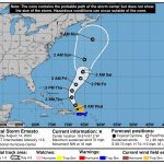
Ernesto, Soon to Be Major Hurricane, Will Veer Far from Coast But Create Dangerous Rip Currents and Surf
Though Tropical Storm Ernesto, which will become a hurricane today, is veering far east of the coast, the Flagler and Florida coastlines will see dangerous rip currents and heavy surf that may further damage beach renourishment efforts in Flagler Beach, starting Thursday. Some of the sand dredged onto the beach there in the last few weeks was eroded by heavy surf from Tropical Storm Debby.
Forecasters Reduce Hurricane Season Forecast of Named Storms from 25 to 23
The university’s Department of Atmospheric Science reduced from 25 to 23 the number of named storms it expects during the season, which started June 1 and will end Nov. 30. The department, however, did not change its prediction of the season producing 12 hurricanes, with six reaching Category 3 or higher status to qualify as major storms.
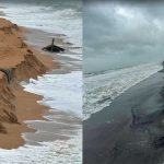
New Beach Erodes in Flagler Beach as Tropical Storm Debby Batters Northern Path with Potentially Catastrophic Rains
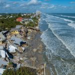
Impacts in Flagler County were expected to be more limited to winds in the 20 to 30 mph range for the rest of the day and some heavy rainfall, but the sea’s impact on Flagler County’s shore was already apparent as churns eroded significant portions of the newly renourished beach at the south end of Flagler Beach, while further eroding the redder, not-yet renourished sands north of the pier.
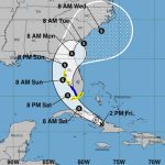
Depression Expected to Become Tropical Storm and Bring Heavy Rain to Region Sunday and Monday
A tropical depression currently moving west-northwest over Central Cuba is expected to become a tropical storm as it crosses the Florida Keys Saturday night, then shear into the area of Tampa Bay and cross the state toward Jacksonville, bringing heavy rain and potential tropical storm conditions to Flagler County between Sunday and Monday, according to the latest forecast of the National Hurricane Center.
Florida Has the Highest Rate of Heat-Related Illnesses, Report Finds
More than 5.7 million Floridians are vulnerable to extreme heat, according to a report from the Florida Policy Institute, which called upon state lawmakers to repeal a new law that prohibits local governments from enacting heat protections for outdoor workers.
Behind One of the Most Active Tornado Seasons on Record
More than 1,100 tornadoes were reported through May − a preliminary number but nearly twice the 30-year average at that point and behind only 2011, when deadly tornado outbreaks tore across the southeastern U.S. The U.S. experienced several multistate outbreaks in 2024.
Hurricane Forecast Ramps Up, Adding 2 Named Storms for Total of 25 as Beryl Is Termed ‘Harbinger’
A day after deadly Hurricane Beryl pounded Texas, experts at Colorado State University on Tuesday increased their storm forecast for what was already expected to be an above-average hurricane season. Including Beryl and short-lived tropical storms Alberto and Chris, the department’s forecast now calls for 25 named storms this season, up from 23 when the first forecast was released in April.
Hurricane Beryl No Threat to Flagler, But Stay Prepared, Emergency Management Director Says
Don’t let it ruin the holiday, though Flagler County officials advise residents to keep an eye on the tropics as they are becoming more active. Stay informed and check personal disaster kits.
‘It Can Happen Here’: Emergency Management Director Warns Against Hurricane Complacency in Flagler Ahead of Busy Season
There’s a dangerous myth in Flagler County, and the longer people have lived here, the more they start believing the myth, and spreading it: that Flagler County is immune to hurricanes. Jonathan Lord, Flagler County’s emergency management director, says ahead of what has been predicted to be the busiest hurricane season in memory that Flagler County is at risk of getting a direct hurricane hit, even a Category 5 hurricane, as any other coastal community in the state.
Florida Preparing for a Hurricane Season with Up to 25 Named Storms
Echoing earlier predictions about the season that will start June 1, the National Oceanic and Atmospheric Administration on Thursday pointed to warm ocean waters and forecast up to 25 named storms, with up to 13 reaching hurricane strength and four to seven packing Category 3 or stronger winds.
Two Tornado Warnings Overnight in Flagler, No Touchdowns
Tornado warnings woke up Flagler County residents in two locations Wednesday morning, at 2:45 a.m. and shortly afterward, but “there was no sign of touchdown anywhere in Flagler County reported to us,” Flagler County Emergency Management Director Jonathan Lord said. The county remains under a tornado watch until early afternoon.
Tornado Watch In Effect for All of Flagler County Until Afternoon as Rounds of Severe Weather Continue
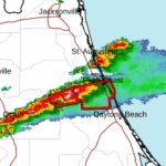
The National Weather Service’s Storm Prediction center in Norma, Okla., issued a tornado watch for Flagler, St. Johns and 17 other northeast Florida counties–but not Volusia–until 1 p.m.. today. The watch is the result of a continuing series of severe weather outbreaks that have left a trail of power outages and a few deaths from Texas going eastward, and that may stretch at least to Wednesday, causing heavy rainfall, localized flooding, damaging winds and isolated tornadoes.
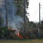
Worrisome Dry Conditions in Flagler Prompt Caution About Wildfires and Yard Kindling
The lack of recent rain means conditions are getting drier in Flagler County, increasing the potential for brushfires. Taking a few precautions now can go a long way to protect homes and businesses from these fires, which can be all too common this time of year.


