


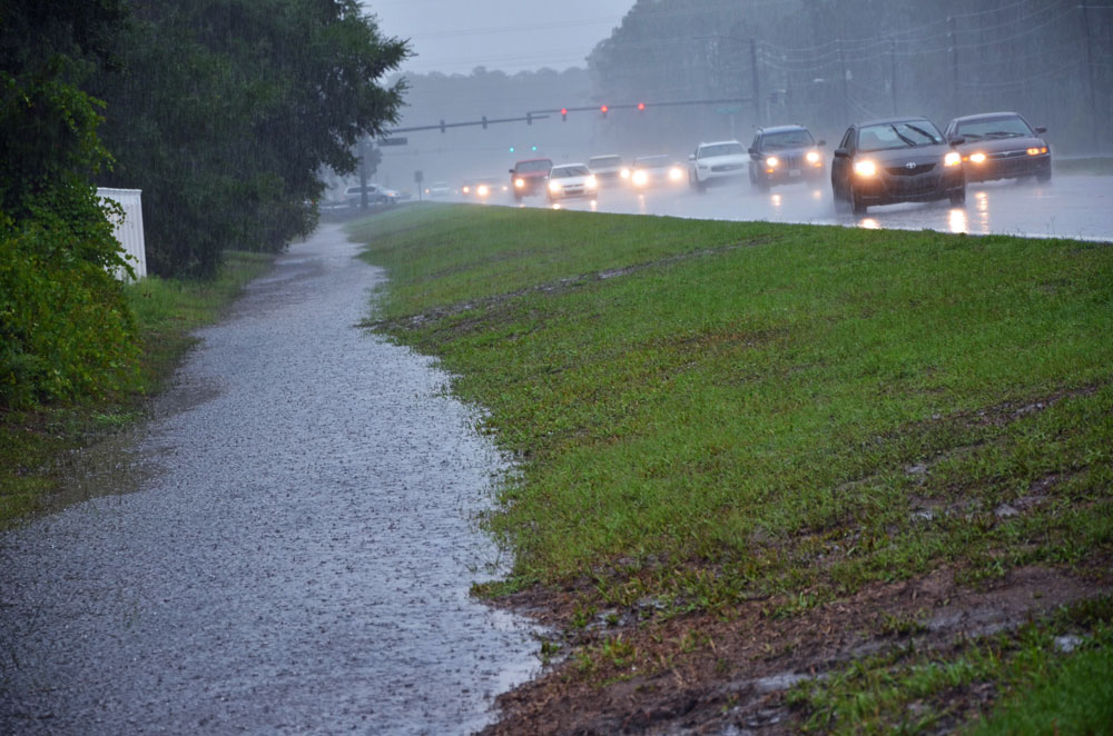
The National Weather Service in Jacksonville is cautioning that a “long-duration nor’easter’ began today and will continue through Saturday, bringing wind and heavy downpours along the I-95 corridor, high tides 2 to 3 feet above normal and dangerous surf that will batter and damage Flagler County’s beaches, and potential coastal flooding. Calmer, dryer weather returns Sunday.
Palm Coast and Flagler County could get between 2 to 3 inches of rain on top of already saturated grounds and undrained swales. The conditions are due to a stalled weather system offshore, combined with so-called king tides, which are caused by a once-a-year alignment of the moon, the sun and Earth “as the ocean is ‘pulled’ back and forth by the gravitational pull of the moon and the sun as these bodies interact with the Earth in their monthly and yearly orbits,” as NOAA describes it.
“We’re watching it. The coastal flooding is predicted to be less than what we saw this week, and the original forecast has diminished a little bit,” with lesser winds than originally forecast, Jonathan Lord, Flagler County’s emergency management director, said at midday today. “We want folks to remain prepared and aware.” (See the latest NWS weather briefing here.)
Erosion has been of particular concern in Flagler County, where long stretches of beach remain critically eroded and recent successions of weather events causing a loss of sand. “As of a day and a half ago, there was definitely some erosion,” Lord said. “There may be some further impacts from the current event.”
Gale warnings for Atlantic waters, coastal flood watches, and high-surf advisories are in effect starting this afternoon and extending through Saturday night. Moderate to possibly major tidal flooding may occur during high tide, including along the St Johns River Basin, from late Thursday through the weekend. The coastal region affected stretches from Brunswick, Ga., to Flagler Beach, with surf building to 6 to 10 feet Thursday, Friday and Saturday. Significant flooding of low-lying roads, docks, boat ramps, and some water inundation of homes and businesses is possible.
Strengthening onshore winds starting today will bring gusts of between 40 and 50 miles per hour from the beaches to the I-95 corridor. Some wind damage is probable with tree limbs downed and a few power outages, according to the weather service. Conditions will create life-threatening rip currents. Waves of heavy downpours and isolated thunderstorms are expected starting this afternoon and through Friday night, which could lead to localized flooding.
While temperatures will be relatively mild through the period, Palm Coast will see winds kick up to 15 to 21 mph this evening, with gusts as high as 31 mph, and stronger winds on Friday (15 to 25 mph, with gusts as high as 38 mph) and Friday night (23 to 29 mph, with gusts as high as 43 mph), and again on Saturday, when the wind will shift from northeast to north (25 to 31 mph, with gusts as high as 45 mph.) Sunday, it’ll be sunny and merely breezy. Similar–and in some places, more hazardous–conditions will affect the eastern seaboard up to the North Carolina-Virginia border, making road travel difficult over the next few days.
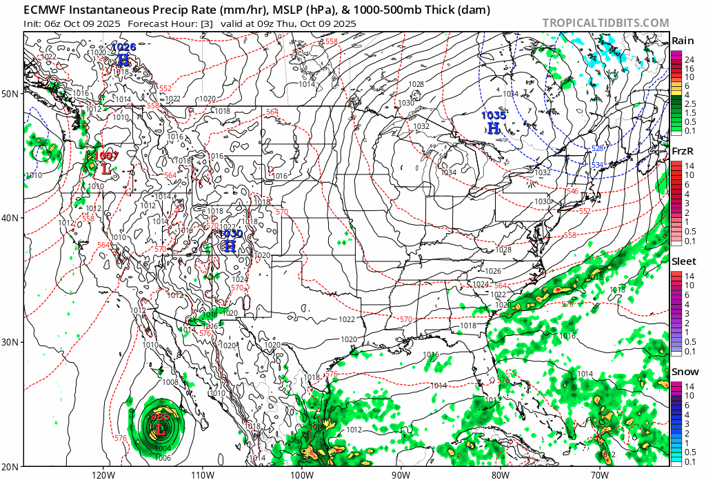
![]()
The precipitation map showing the nor’easter moving up the coast through Monday (from Tropical Tidbits):


Ray W. says
Newsweek reports that the impact of this week’s King Tides on Daytona Beach will peak on Saturday, when the tides reach their highest level.
According to the reporter, Fox 35 senior meteorologist, Brooks Garner, posted this to X:
“No beach to be found at Daytona Beach? It’s just ‘Daytona’ right now because an extreme high tide known as the, ‘King Tide’ has pushed water all the way up to the seawall and dunes, amplified by a relentless onshore wind. … Erosion to newly nourished areas is actively in progress.”
Deborah Coffey says
Oh boy! A good and thorough update! Thank you.
don miller says
no more. anyone with a brain told knew all beach nourishment was a waste the way they were doing it. You should see how deep the sand is in OB that washed down from flagler. have to kneel to use the shower.
Brian Riehle says
After living through 25 years of storm seasons and beach re-nourishment here in Flagler County, the score is still
Mother Nature -25 and the Army Corps. of Engineers -0.
And the Band plays on.
Good money after bad says
Let me guess. Time to dump more sand
oldtimer says
Let’s put up more houses and pave more wooded areas so the water has even less places to go