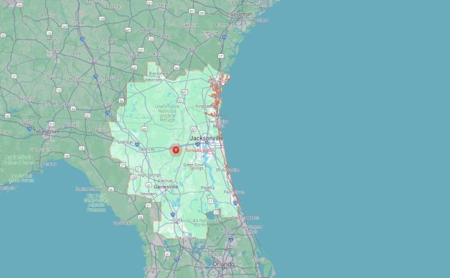
The National Weather Service’s Storm Prediction center in Norma, Okla., issued a tornado watch for Flagler, St. Johns and 17 other northeast Florida counties–but not Volusia–until 1 p.m.. today. The watch is the result of a continuing series of severe weather outbreaks that have left a trail of power outages and a few deaths from Texas going eastward, and that may stretch at least to Wednesday, causing heavy rainfall, localized flooding, damaging winds and isolated tornadoes.
Today’s tornado watch extends into southeast Georgia. A watch means conditions are propitious for severe storms. You should be ready to act quickly if a warning is issued or you suspect a tornado is approaching. A warning, always more localized, is issued when either weather spotters or radar have spotted a tornado or rotating clouds. A tornado emergency is a confirmed touchdown threatening lives and property.
For Palm Coast and surrounding areas, the National Weather Service in Jacksonville predicts a 50 percent chance of thunderstorms, mostly after 10 a.m., some of them producing heavy rainfall–a benefit to the area, which had been getting a bit parched for lack of rain until last week, raising fears of a busy fire season. Flagler’s drought index remains at a slightly elevated average of 407 on the 800-KBI scale, with lower values reflecting saturation and higher values reflecting dry to drought conditions. The same stormy and raining conditions are predicted to continue locally until mid-afternoon Wednesday. For Flagler Beach, the chance of rain is only slightly lower. A small craft advisory is in effect for Atlantic coastal waters.
The weather system moving through the region has already produced severe and deadly weather in Louisiana, where at least two people were killed overnight in Henderson and West Baton Rouge and others injured from two confirmed tornadoes, Calcasieu Parish near Sulphur and one in Lake Charles. The storm system triggered 14 tornado warnings in Alabama on Monday. Texas experienced hail storms. Some 105,000 customers lost power across five states, including 14,000 in Florida, after last week’s three EF-2 tornadoes in the Tallahassee area killed a person, knocked out power for 160,000 people, and caused the governor to declare a state of emergency in a dozen counties.
![]()


JOE D says
I REALLY appreciated the 6:26 am ALERTFlager cell call ( and text, and email…I signed up for all modes of notification). At that time (I’m retired), I don’t have my radio or TV on, so the CELL call and text…was the ONLY way to get the notification.
Of course that got me up and READY early…(can’t face a TORNADO with STUBBLE)/ fully dressed with SHOES, not sandals. Made breakfast then (just in case there is a power loss later).
Debated if I should pull the hurricane shutters closed ….YES! Made sure the flashlight battery was charged (as well as phone, and portable radio). Filled 1/2 gallon pitcher of water in fridge.
Made sure my battery pack(and plug in and car plug) powered Go Sun cooler was fully charged.
My townhouse has an interior (no windows ) bath….and a 9×9 walk through closet ( which “technically” is a SAFE ROOM for storms). Guess I’m ready…..IF…
Guess it’s GOOD PRACTICE….Hurricane Season begins June 1.
Thank you ALERTFlagler!
Pogo says
@While we listen to the sounds of nature
@Teachers, nurses, deputies, fire departments, grocery store cashiers, and news reporters, listen too, while on the job.
Thank you all, and all not named, too.
JimboXYZ says
Hurricane David/Tornado Alfin beat Mother Nature to clearing a path of trees from Royal Palms Parkway to I-95. Higher taxes to follow in the aftermath.
dave says
Wow, 4am this morning, weather alert hit my cell phone for a Tornado Warning in our area. Well at least the alert works and it DID GET MY attention.