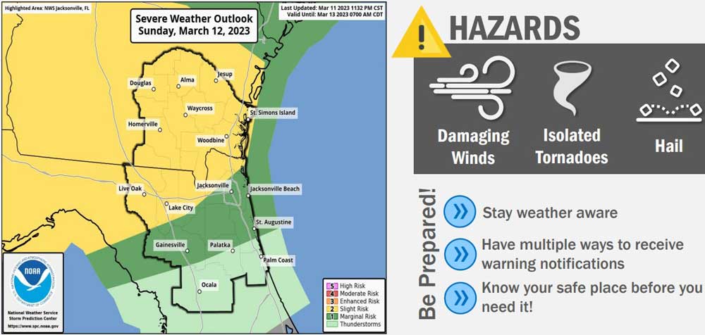
A Low-pressure system and accompanying cold front will generate strong to severe thunderstorms Sunday afternoon into Monday in Northeast Florida and Southwest Georgia. The squall line is expected over Flagler County between 11 p.m. this evening and 8 a.m. Monday. after 7 p.m.
All hazards, including isolated tornadoes, hail, and damaging winds–of between 40 to 60 miles per hour, causing downed trees and some power cuts–are possible, but less likely as the storm moves southeast. By the time the line of storm reaches Flagler, the hazard risk will be marginal, according to the National Weather Service in Jacksonville.
Along the shore, the rip current risk is rated high today. A small craft advisory will be in effect Monday.
The main area of thunderstorms will be focused along the cold front and organized into that squall line as it pushes south through southeast Georgia Sunday afternoon and evening, the National Weather Service in Jacksonville says. The threat of severe thunderstorms will continue Sunday evening and overnight and shift south into northeast Florida.
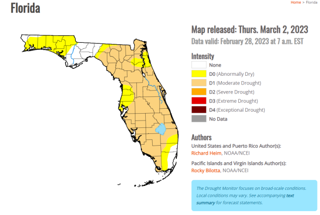
Flagler County can use a little more rain: February’s rainfall totals were well under 2 inches across the region, with parts of the county, including Palm Coast (1.49 inches), North palm Coast (0.42) and Eagle Rock (1.05) well short of the normal 2.67 inches expected this month.
“The Climate Prediction Center (CPC) is indicating that drought conditions have developed, and a moderated (D1) drought exists,” Bob Pickering the weather specialist at the Emergency Operations Center, noted in his monthly weather report. “The National Interagency Fire Center is forecasting Above Normal wildfire potential for next month.”
Locally, Sunday will be mostly sunny and warm, turning cloudy as the day progresses. Tonight’s chance of rain is around 50 percent, rising to 70 percent Monday. A cold front behind the storm will bring much lower temperatures with lows in the 40s Monday, Tuesday and Wednesday night and highs in the 60s Tuesday and Wednesday.
![]()


Jimbo99 says
More concerned with the bike week people, so there is no repeat of Friday AM & PM casualties riding around in the inclement weather.