The exercise was based on a simple if destructive scenario: a tornado had ripped through a 50-acre zone, demolishing some homes, damaging others, and resulting in one missing 5-year-old boy, though the participants did not know that someone had gone missing until they discovered the damaged home.
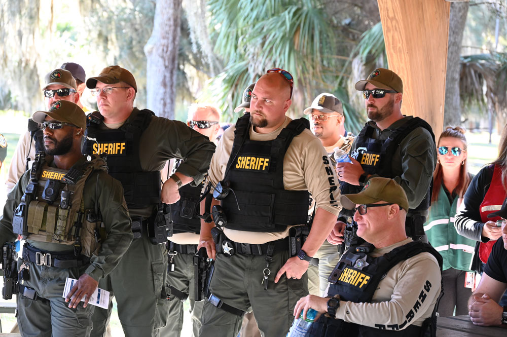
Flagler County Fire Rescue personnel joined with Flagler County Sheriff’s deputies, Flagler County Emergency Management and the county’s IT and GIS teams this morning and into the middle of the afternoon at Princess Place Preserve for the first joint exercise in more than half a decade. Up to 75 participants were involved at all levels, according to Emergency Management’s Jonathan Lord.
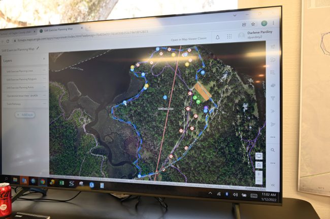
The search-and-rescue exercise had a particular focus: learning to use Quick Capture, an ESRI app developed for first responders by GIS (geographic information system) experts to enable responders to map and communicate in real time emergencies from rescue events to tornado and hurricane damage. They can do so from their phones and in a coordinated way that gives all those involved in the efforts access to the same data, whatever agency they may be from. The data could be generated from law enforcement on the ground, firefighters or drones, as it was today. It can be shared across jurisdictions or agencies, so if, say, Flagler responders are deployed in another state on a mutual aid mission–as happens frequently–they can log into the app and essentially be on the same wavelength as all other responders in the area, assuming the agencies there use it.

Until now, responders have relied overwhelmingly on computer-assisted dispatching, or CAD, the communications system that routes through a community’s 911 center and that gives every responder in the field access to the same rundown of an incident’s response, on electronic devices, in real time. But CAD has its limitations: it doesn’t enable imagery or video, nor does it interface with GIS systems–at least not outside the 911 center, where GIS plays an important role–that immediately map locations or addresses.
The app amplifies other remote capabilities: “I could log in today and see, wow, we’ve got a problem over in Bay County. I wonder if there’s anything we can do to help,” explained Darlene Pardiny, the county’s GIS manager, who played a central role in the Princess Place drill. “And I do that all the time. I email, I’ll find out who the GIS manager is there. I’ll be like, Hey, you guys need anything I have from here. We’ve helped with the wildfires for last few years. We helped with the flooding in Michigan. But I don’t leave my office.”
In early 2020 the app was used at Waterfront Park in palm Coast in the search for a missing biker (who was not found). Deputies used the app to live-track every location they searched, which allowed them to know what grounds not to revisit–and allowed authorities to show the victim’s family evidence of the thoroughness of the search. “So when the sheriff’s office went back to the family and said we didn’t find anything, they could confidently say that and show them: This is where we searched,” Pardiny said.

As she spoke, the responders involved in today’s exercise were deploying in the field and conducting damage assessment of the tornado’s damage. (As in all exercises, a measure of imagination was needed. Princess Place was the location, but the idea was to imagine a somewhat more inhabited environment. The grounds had bee prepared ahead of time, with existing structures or even trees tagged for the exercise, so the responders could react to what they saw, and report on it. In the early moments of the exercise, the responders could not know more than that a tornado had ripped through. The 911 center has received upwards of 50 calls. Dozens of people require medical attention. Some homes are completely destroyed, others damaged. Two elderly people may have suffered strokes. There are electrical fires, gas leaks, power outages.
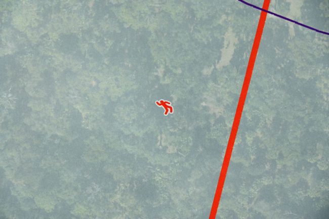
Periodically, there is a so-called “inject” into the exercise, a curve ball of sorts that responders have to react to: a residential home has collapsed, an apartment structure is lightly damaged, another has had a total roof collapse, but no victims are located. Then another “inject”: A little boy has gone missing. At that point, the search component kicks in. Meanwhile all damaged structures and other elements responders have encounters are documented and turned into visual data, which, even then, someone like Todd Largacci, the GIS supervisor at the Flagler County Property Appraiser’s Office–who was part of the exercise–could start analyzing. The responders can also document “human interactions”–who is being evacuated, how, what may be needed to carry out an evacuation, and so on. “Everybody brings something different to the table,” Pardiny said.
Each responder’s role is narrowly defined to maximize effectiveness: “So by dropping a point,” Pardiny said, using the terminology of a geographic point logged in by a responder at any given point of the mission, “attaching a photo, incident command gets it, they open it, yep: We can’t send just anybody. We’ve got to figure something else out. So when they deploy a resource, they deploy the right resource the first time, and then that person that’s doing that pass continues to go. They don’t stop to assist because they’re not equipped to assist.” Nikki North, the sheriff’s Real Time Crime Center supervisor, was among those in the incident command center.
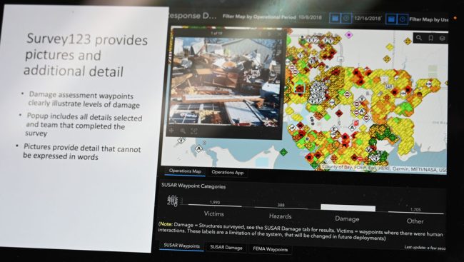
Live footage from two drones was also to be part of the drill (The county has a squadron of 11 drones in all.) T.J. Lyon of the Florida Fire Chief’s Association, who is among those who developed the app and was at the exercise, showed a map of the data the app generated during Hurricane Michael in the Panhandle–a map blanketed by a color-coded mosaic of pinpoints, each with its own reams of reported data. The Princess Place drill was to generate a similar, if smaller-scaled, map by mid-afternoon, when the missing boy was presumably found and the teams headed back for debriefing.
“These are the tools we have available to us to use it with different folks that are trained and using these tools,” Flagler Emergency Management Chief Jonathan Lord said just before the exercise began. “It doesn’t matter what their badge says or what their uniform says at the end of the day. They can all come together and help our residents. And that’s very exciting. This is a learning event as well, because some folks are using some of the tools for the first time. But it’s a time to prove that we can coordinate together and do things as a team.” (The Palm Coast Fire Department did not send firefighters, but all its firefighters were trained in the use of Quick Capture previously.)
“Every deputy is trained in emergency response training,” Sheriff Rick Staly said. “But we then have a specific team, that this is their collateral duty assignment. We don’t have full time functions like big metropolitan areas do. And so this is focused training with all the different disciplines that you see here on how we interact, how we communicate. Because you want to do this training before a tornado comes through, before hurricane comes and be prepared.”
The last times law enforcement, firefighters and Flagler County Emergency Management held joint exercises were in 2014 and 2015, when then-Emergency Management Chief Kevin Guthrie led a mass-casualty drill to test the hospital’s capabilities and the Sheriff’s Office led an active-shooter simulation at Flagler Palm Coast High School.
![]()


Jay Tomm says
Well, I guess at least we know where our taxes are being spent….
IDK, seems very overkill for such a small county as Flagler.
TS says
Until your kid is lost.
Concerned Citizen says
Flagler County is not all that small anymore.
And speaking as an Emergency Services volunteer. Exercises like these are critical. If a child or alzheimers patient is lost time is critical. You can’t always count on air support. Any technology you can add to your resources makes it that much more possible to have a successful mission. And training helps keep that edge.
There is also funding available from different sources that make this possible without affecting taxes.
If your really concerned about how taxes are spent there are multiple ways of volunteering in your community. And helping to make a difference.
Rufkutdiamnd says
Can you imagine if this technology was combined with the computer reenactment of the Surfside condo collapse how much faster the teams could have focused on the area of where the ones who didn’t initially die in the collapse. Those are 9 people that didn’t have to die. Flagler Beach FD needs to get on board since they have condos over 2 stories. Every county needs the technology that the Israeli defense team used in building collapse.
Techie says
Thank you for recognizing the value of technology. Actually, FEMA did use this app in the Surfside collapse. There could have actually been many more casualties, although even one is very unfortunate. Flagler Beach Fire Dept has trained on the app, Flagler County GIS visited every station 3 times last fall to provide small group trainings to staff at every fire agency in the county.
I understand why some folks that aren’t more involved in public safety might think that this is wasteful, the professionals train and practice so when they deploy for a real incident it looks easy to the general public. Yesterday, Lee, Charlotte, Collier & Hendry had a very high wind event. Lee County activated a shelter for approximately 200 residents that experienced damage to their home from the storm. Charlotte County had approximately 65 they sheltered. Within a couple of hours they’d completed 304 assessments of damage, documented with photos. Located two separate situations where individuals were trapped within their severely damaged homes and extricated them to safety/medical care and began to efficiently begin clean-up because they knew precisely what needed done where because of the data gathered by the First Responders. Thank God for technology, and for those that can tune out the negativity and focus on what they know really needs done. Fortunately, our county invests in training, technology and continues to move forward with innovative approaches.