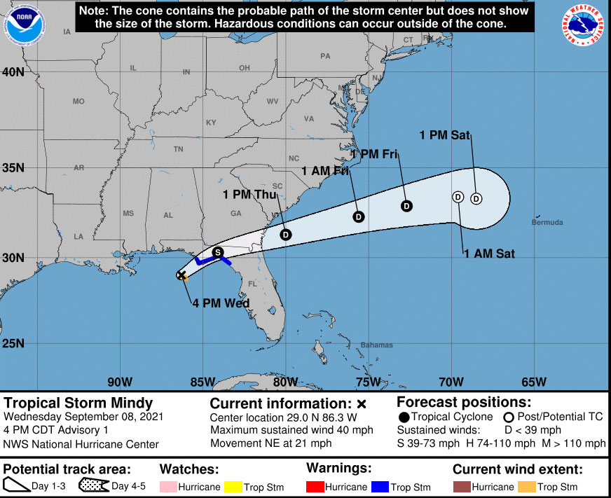
Thursday morning update, 7 a.m.: Mindy was downgraded to a tropical depression at 5 a.m. this morning, and will continue to move quickly east-northeast today and off the southeast Georgia coast later today, the National Weather Service in Jacksonville says. The main lingering impacts from this system will be locally heavy rainfall, wind gusts of 30-40 mph, and a very low potential for a tornado over northeast Florida this morning.
Wednesday, 7 p.m.—Tropical Storm Mindy formed late this afternoon over the northern Gulf of Mexico and veered east in a rapid trek expected to take it from Florida’s Big Bend through the northeast portion of the state over the next 24 hours. Impacts in Flagler County are expected to be limited to rain and some wind, but the county’s emergency chief cautions about rapidly changing patterns.
“We are not expecting a hurricane but systems like this one can change in intensity and direction with little notice, so we are asking residents to be alert,” said Emergency Management Director Jonathan Lord just before the storm became the 13th named system of the season.
While expected rainfall is only about one inch, localized amounts of three to five inches are possible. A few strong storms may also occur, but currently the bulk of the rainfall and higher risks of severe weather remains outside of the Flagler County area, a county advisory stated.
The National Weather Service in Jacksonville said Mindy would bring widespread downpours and an isolated tornado threat overnight in the Suwannee Valley. Winds may gust to tropical storm force along the Interstate 10 corridor, particularly within heavier rain bands, as Mindy moves quickly east-northeastward along the Interstate 10 corridor overnight, through the Okefenokee Swamp during the early morning hours on Thursday, and then offshore of coastal southeast Georgia before noon tomorrow.
The storm was traveling at a brisk 21 mph pace late Wednesday afternoon. By the time the storm reaches northeast Florida, it was have degraded back to a tropical depression. But as recent experiences in the wake of hurricanes indicate, downpours resulting in dangerous, localized flooding are still a possibility. Only one other major storm is churning in the Atlantic at the moment–Hurricane Larry, whose path will not see land anywhere but perhaps the tip of Newfoundland by Saturday, as it makes a run for Greenland.
If there is a silver lining to Mindy’s pass, it may be taking with it the last of the summer’s higher temperatures: the National Weather Service in Jacksonville has high temperatures in the 80s from Thursday on through the next seven days. The full Mindy briefing is below.
Click to access nws-jax-briefing-17.pdf


Leave a Reply